Coyote Buttes South (Vermillion Cliffs, UT)
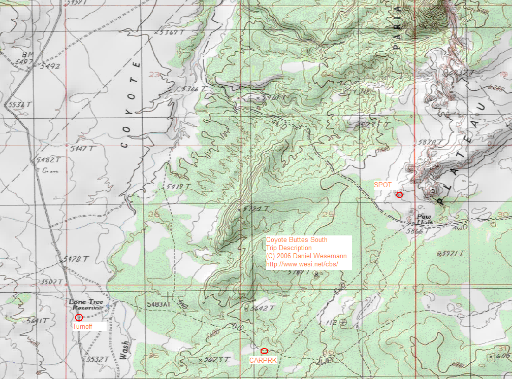
From there, we ventured cross-country, roughly paralleling the sandy road and heading for the SPOT (36.9276, -112.0184) in the cliffs above Paw Hole. The last coordinates are a bit less precise than others - I sure ain't going to tell you where my favorite spot in the Southern Coyote Buttes is. It's not necessary anyway, once you get close to the above coordinates, I'm pretty sure you'll find plenty of sweet places that YOU like and won't tell anybody about either :-).
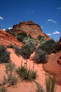
Once up on the plateau above Paw Hole, we continued about one mile further into north north easterly direction and then slowly circled and meandered back towards Paw Hole. There's lots of exploring you can do up there, and usually ample solitude to be had even on weekends. If you go to the right places, you'll find lots of wavy rock formations, and while none of them are as spectacular as the "Wave" is, these formations are yours to discover, and haven't already been photographed a gadzillion times from the exact same spot and angle.
Note that to venture into the Southern Coyote Buttes, you require a Permit which can be acquired for 5 USD at the Paria Contact Station up on Highway 89. Please don't go to the Coyote Buttes without seeing the ranger first and paying your fee. National Park Passes don't count. The contact station also has maps on sale which are of better quality than what you get by printing out my map (624 kB). Since the valley road crosses the muddy Buckskin river about 1.5mi south of Hwy 89, you'll have to expect that you cannot get across after a rain or thunderstorm. The park authorities usually send a grader down the track after a muddier flood, but in any case you won't be land-locked on the far side of the Buckskin as it is usually possible to drive out towards the south. If not, sit back and relax, the conditions won't last for long. (back to travel overview)